| Stromboli | ||
| 1. Altitude profile |
 |
|
| 2. Hiking Track | ||
| 3. Activity plots | ||
|
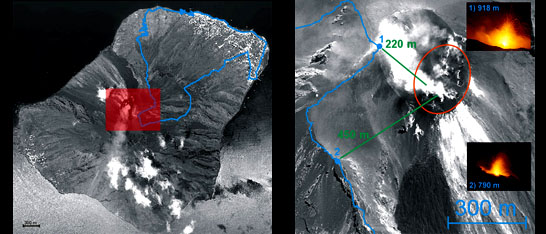
Shown in blue is the track to the summit based on GPS
measurements. Green indicates the distance to the active vents from
two observation points (1 summit 918 m and 2 790 m).
|
||